The Sea Between Us, or the Sea That Connects Us?

When looking at a map of Indonesia, it is easy to notice the spaces between the islands.

Blue stretches of water appear to separate Sumatra from Java, Java from Kalimantan, Sulawesi from Maluku, Maluku from Papua, and thousands of smaller islands from one another.

From a land-centred perspective, the sea can look like a gap.

A distance.

Something that must be crossed before reaching somewhere else.

But what if we looked at it differently?

What if, for many communities across the Indonesian archipelago, the sea was never simply the space between places?

What if it was one of the things that connected them?

When Water Was a Pathway
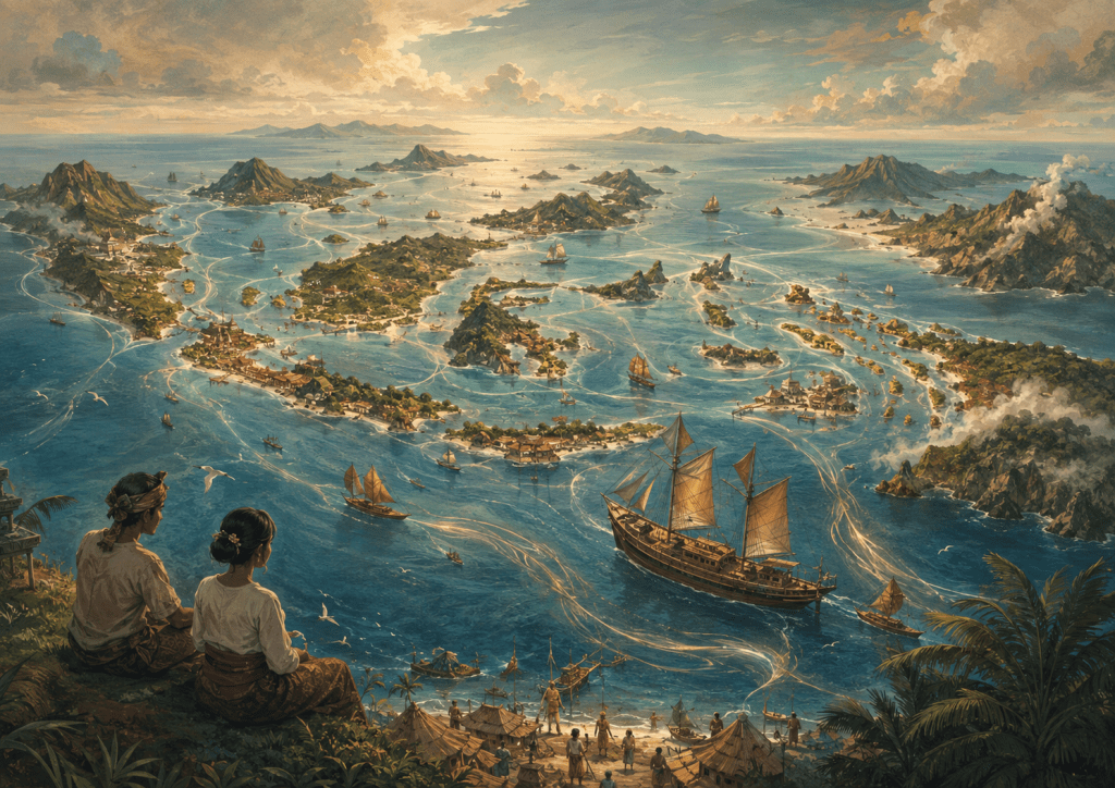
This image is an artistic illustration created for this post. It is not an accurate or official map of Indonesia, but a symbolic representation of the archipelago and the sea as a space of connection.

Long before modern roads, airports and administrative boundaries shaped the way we imagine Indonesia, people travelled through the archipelago by water.

Boats carried people, food, tools, stories, languages, beliefs and knowledge.

Coastal settlements and ports became meeting places. People did not only exchange goods; they encountered different communities and ways of understanding the world.

These maritime connections extended across the archipelago, from the western islands of Sumatra and Java, through Kalimantan, Sulawesi and Maluku, and eastward towards Papua.

In this sense, the sea was not empty space.

It was a pathway.

The movement of people across water created relationships between places that might appear distant when viewed from land.

A community on one island could have social, cultural or economic connections with another community across the sea.

The coastline was not necessarily the end of someone’s world.

Sometimes, it was where another world began.

Islands Do Not Always Mean Isolation

Today, we often describe Indonesia as a country made up of thousands of islands.

The description is geographically correct, but the way we imagine those islands matters.

If we see every island as an individual piece of land surrounded by water, we may unconsciously imagine Indonesia as a collection of separated territories.

But an archipelago can also be understood as a network.

Within that network, the sea is part of the connection.

People navigate through it.

They depend upon it.

They learn its seasons, currents and winds.

They build livelihoods around it.

And through generations of movement, maritime routes can become social and cultural routes as well.

This is also important when thinking about eastern Indonesia. Maluku and Papua should not be imagined simply as distant edges of the map. They are part of wider maritime worlds shaped by movement, exchange, coastal relationships and connections extending across surrounding seas.

Perhaps this is one reason why understanding Indonesia only from the land gives us an incomplete picture.

The Sea Carries More Than Boats

The sea has carried much more than vessels.

It has carried language.

Food.

Music.

Family connections.

Trade.

Migration.

Religious ideas.

Technology.

Stories.

And memories.

Across generations, these movements contributed to the extraordinary diversity that exists throughout Nusantara, including the many distinctive coastal and island communities of eastern Indonesia and Papua.

Different places maintained their own identities, yet they were rarely completely disconnected from the worlds around them.

The sea allowed encounters to happen.

Sometimes peacefully.

Sometimes competitively.

Sometimes through migration, trade, political expansion or conflict.

Maritime connection does not mean that the history of the archipelago was always harmonious.

But it reminds us that water has continually participated in shaping relationships between people and places.

Changing the Way We Look at the Map

Perhaps we can try a small exercise.

Look at a map of Indonesia again.

This time, instead of looking first at the islands, look at the blue.

Look at the Malacca Strait.

The Java Sea.

The Makassar Strait.

The Flores Sea.

The Banda Sea.

The Arafura Sea.

The waters surrounding Maluku and Papua.

And the many other seas and straits that weave around and between the islands.

Suddenly, the map can tell a slightly different story.

The water does not disappear.

It becomes part of the geography we pay attention to.

And when we begin recognising the sea as a space of movement, memory and interaction, Indonesia starts to look less like scattered pieces of land and more like an interconnected maritime world stretching from Sumatra to Papua.

What Does This Mean for Maritime Identity?

Being an archipelagic country does not automatically mean that everyone identifies with the sea.

Many Indonesians grow up far from the coast. Their everyday lives may be shaped more strongly by farms, mountains, cities, rivers or forests.

This is particularly important in a country as geographically and culturally diverse as Indonesia, where communities in places such as the highlands of Papua may have relationships with landscape that are very different from those of coastal communities.

Maritime identity therefore does not need to mean that every Indonesian must think like a sailor.

Perhaps it can mean something broader.

It can begin with recognising that the sea has played an important role in shaping the relationships between our islands, communities and histories.

The sea can be understood not only as a resource to use or a boundary to defend, but also as part of the cultural and geographical fabric that has connected people across Nusantara.

And perhaps that changes one simple question.

Instead of asking:

What separates one Indonesian island from another?

We might also ask:

What has connected them?

Sometimes, the answer has always been there—

flowing quietly between the shores.

The sea.
Before We Knew the Word “Maritime”, We Sang About the Sea

Nenek Moyangku Orang Pelaut and the Quiet Inheritance of Indonesia’s Maritime Imagination

Long before many of us understood words such as maritime, archipelago, ocean governance, or maritime identity, we may already have encountered the sea through something much simpler:

a children’s song.

For generations of Indonesians, Nenek Moyangku Orang Pelaut has been one of those familiar songs carried from childhood.

Written by Ibu Soed, or Saridjah Niung, the song has become closely associated with the image of Indonesia as a maritime nation and with memories of earlier generations whose lives were connected with the sea.

But perhaps what makes the song especially interesting today is not only what it tells us about the past.

It is what it may quietly have taught us about the sea.

Before Maritime Became a Concept

Children do not normally begin by learning definitions of maritime culture or maritime identity.

They encounter the world differently.

Through stories.

Through family memories.

Through places.

Through language.

And sometimes through songs.

Nenek Moyangku Orang Pelaut introduces the sea not through geography or policy, but through ancestry.

The opening idea is simple yet powerful: our ancestors were seafarers.

In that sentence, the sea is already more than water surrounding the islands.

It becomes connected with memory, movement and belonging.

Perhaps, before we could explain what it meant to be part of an archipelagic nation, we had already begun imagining ourselves in relation to the sea.

The Sea Is Not Merely a Background

Another interesting aspect of the song is the kind of sea that it imagines.

It is not a motionless blue landscape.

It is a space of waves, wind, storms, sails and journeys.

The maritime world presented to children is therefore one of movement and uncertainty.

To go to sea requires interaction with forces that cannot simply be controlled.

There must be courage, adaptation, knowledge and an ability to continue moving through changing conditions.

Seen from this perspective, the song can be read not simply as a celebration of seafaring, but as an early cultural image of a maritime mindset.

A maritime mindset does not necessarily mean that everyone must become a sailor.

Rather, it may involve ways of thinking shaped by movement, connection, uncertainty, resilience and an awareness that the sea is an active part of our lives.

A Quiet Cultural Inheritance

The words nenek moyangku are also important.

They connect the present with earlier generations.

This does not mean that every Indonesian shares the same maritime history or that maritime identity should be understood as something automatically inherited.

Indonesia is extraordinarily diverse.

Relationships with the sea differ across islands, communities, cultures and generations.

For some communities, the sea remains part of everyday life.

For others, particularly those living far from the coast, the relationship may be more distant.

Yet songs, stories and collective memories can allow ideas about the sea to travel far beyond coastal communities.

In this sense, maritime imagination can become a form of cultural inheritance.

Something can remain within collective memory even when our daily lives have moved far away from the circumstances that originally shaped it.

From Ancestors to the Present Generation

This is where the song becomes especially interesting for CitaNesia.

Singing that our ancestors were seafarers is one thing.

Asking what that inheritance means today is another.

Indonesia has changed dramatically.

Most Indonesians will never spend their lives navigating the open sea.

Technology has transformed transportation, communication and maritime activity.

Yet the sea continues to shape the country.

It connects islands.

It supports livelihoods.

It carries trade.

It contains ecosystems of extraordinary importance.

It influences culture, security, food systems, energy, climate and Indonesia’s relationships with the wider world.

Perhaps, then, carrying a maritime inheritance today does not simply mean remembering that earlier generations sailed.

It may also mean developing a contemporary relationship with the sea.

That could involve understanding marine environments.

Respecting coastal and maritime communities.

Protecting ecosystems.

Learning about Indonesia’s maritime history.

Recognising the importance of sea connectivity.

Developing maritime knowledge.

Or simply remembering that the waters between Indonesia’s islands are not empty spaces separating the nation.

They are among the spaces that connect it.

When a Childhood Song Becomes a Question

Perhaps many of us sang Nenek Moyangku Orang Pelaut without thinking very deeply about its meaning.

That is perfectly natural.

We were children.

But returning to the song later in life allows a different question to emerge.

What kind of relationship with the sea did those simple words quietly introduce to us?

Perhaps maritime consciousness does not always begin in universities, government policies or strategic documents.

Sometimes it begins much earlier.

In a classroom.

In a family story.

In the memory of a harbour.

In the vocabulary of a community.

Or in a song that children sing before they even know what the word maritime means.

And perhaps the question for our generation is no longer simply:

Were our ancestors seafarers?

The more important question may be:

What kind of maritime generation do we choose to become?


CitaNesia Reflection

CitaNesia explores maritime mindset not as a requirement that every Indonesian must think about the sea in the same way, but as something that can grow through knowledge, experience, culture and reflection.

Nenek Moyangku Orang Pelaut offers a small but fascinating example.

A children’s song may seem simple.

Yet within it can travel memories of ancestors, ideas about courage and movement, and an imagination of Indonesia in which the sea has never been entirely separate from who we are.

Perhaps that is one of the quiet ways a maritime mindset begins.

The Sea as a Way of Thinking: Learning from Indonesia’s Maritime Communities

Indonesia is often described as a maritime nation. Thousands of islands are connected by seas, straits, coastal settlements, trading routes, fishing grounds, and generations of human movement across the archipelago.

Yet a maritime nation is not created by geography alone.

Being surrounded by the sea does not automatically mean that people think about the sea as part of their everyday identity. A maritime mindset develops through relationships: through experience, knowledge, memory, livelihood, culture, and repeated interaction with marine environments.

Across Indonesia, many coastal, island, and sea-oriented communities have maintained particularly close relationships with the ocean. For some communities, the sea is not something located at the edge of life. It is part of life itself.

People live beside it, travel across it, learn its rhythms, depend upon its resources, pass knowledge about it between generations, and incorporate it into social and cultural practices.

This offers an important way of thinking about maritime mindset.

When the Sea Is Part of Everyday Life

A maritime mindset does not necessarily begin with formal maritime education or national policy.

It can begin much more quietly.

It may grow through a child watching family members prepare a boat, learning when the tide changes, recognising different winds, listening to stories about particular islands or fishing grounds, or understanding that weather conditions influence when people can travel.

Through experiences like these, the sea becomes more than a physical environment.

It becomes familiar.

It becomes meaningful.

And, over time, this familiarity can influence how people understand their place within the wider world.

Indonesia’s coastal and sea-oriented communities demonstrate that relationships with the ocean can become deeply embedded in everyday knowledge and social life. Communities such as the Sama-Bajau, for example, are frequently associated with long histories of maritime mobility and close relationships with marine environments across parts of maritime Southeast Asia.

Their experiences should not be simplified into a single image of “sea people”. Communities are diverse, contemporary, and continually changing. Nevertheless, their long-standing relationships with marine environments remind us of something important:

Maritime thinking can be cultivated through living relationships with the sea.

Maritime Mindset Beyond Coastal Communities

This does not mean that everyone in Indonesia needs to live beside the ocean or adopt the lifestyles of maritime communities.

Instead, these communities can inspire a broader question:

What can the rest of us learn from people who have never treated the sea as distant from everyday life?

Perhaps maritime mindset begins with recognising connection.

Someone living hundreds of kilometres from the coastline may still depend upon maritime transportation, seafood supply chains, ocean climate systems, ports, coastal ecosystems, or economic activities connected with the sea.

The relationship may be less visible, but it still exists.

Developing a maritime mindset therefore does not require everyone to become a sailor, fisher, marine scientist, or coastal resident.

It requires recognising that the sea matters.

It means becoming more aware of how maritime environments connect communities, livelihoods, cultures, economies, histories, and futures.

From Maritime Heritage to Maritime Awareness

Indonesia possesses extraordinary maritime traditions. But maritime heritage becomes especially meaningful when it continues to inform how contemporary society understands the ocean.

Traditional and Indigenous knowledge can therefore offer more than historical stories. It can remind wider society that relationships with marine environments have long been forms of knowledge in themselves.

Observing currents, seasons, weather, species, navigation routes, coastal changes, and marine conditions requires attentiveness developed through repeated interaction with place.

Such relationships demonstrate that maritime knowledge is not produced only inside universities, government institutions, or research organisations.

Knowledge also lives within communities.

It travels through generations.

It grows through practice.

And it develops through continuous relationships between people and their environments.

A Maritime Mindset for a Wider Indonesia

Perhaps one challenge for a large archipelagic country is ensuring that the ocean remains present in the minds of people even when it is not visible from where they live.

Indonesia’s maritime communities offer an important source of inspiration.

They remind us that the sea does not have to remain somewhere beyond the shoreline.

It can become part of how people understand connection, responsibility, heritage, livelihood, and belonging.

A maritime mindset does not require everyone to share the same maritime identity. Different communities will experience the ocean differently, and those differences are part of Indonesia’s richness.

What matters is maintaining an awareness that the sea is not simply the space separating Indonesia’s islands.

It is also one of the spaces that connects them.

Perhaps strengthening Indonesia’s maritime future therefore begins not only with ports, ships, policies, or infrastructure.

It also begins in the mind.

By listening to communities whose relationships with the sea have endured across generations, Indonesia can continue learning how maritime awareness might grow far beyond the shoreline—and remain present within the wider national imagination.

CitaNesia Reflection — Maritime Mindset

This reflection forms part of CitaNesia’s exploration of how maritime ways of thinking can grow through culture, knowledge, experience, and everyday relationships with the sea. It does not suggest that Indonesia has one single maritime identity; rather, it recognises the diversity of relationships through which people understand and experience the ocean.

Maritime Identity Development in Indonesia

Research, reflection and a continuing conversation about Indonesia’s maritime future

Indonesia has always been maritime.

Long before the language of contemporary maritime policy emerged, communities across the archipelago had lived with, travelled across, worked upon, learned from and built relationships around the sea.

Indonesia’s maritime identity did not begin with a policy, an institution, or academic research.

It has existed across generations—in histories and cultures, coastal communities and livelihoods, navigation and trade, knowledge and traditions, ports and fisheries, islands and the countless relationships connecting people with the waters between them.

My academic journey led me to explore one particular question within this much larger story: how might Maritime Identity Development—or MID—help us understand the relationship between people, identity and Indonesia’s maritime future?

The formal research journey has been completed.

But my curiosity has not.

This page is a space for that journey to continue.

From academic research to public conversation

Academic research is usually communicated through dissertations, journal articles, conferences and other scholarly publications. Those forms matter, and research intended for scholarly publication belongs within the appropriate academic processes.

This space has a different purpose.

Here, I hope to gradually communicate some of the ideas, questions and reflections that emerged through my academic journey in language that can travel beyond academic writing.

It is not intended to reproduce my dissertation or replace scholarly publications.

Instead, it is a personal space for research communication, reflection and continuing learning—a place where I can explain ideas in more accessible ways, revisit questions that stayed with me, connect them with new conversations, and continue thinking about Indonesia’s relationship with the maritime world.

I also hope it can become a place for conversation.

MID emerged through academic research, but questions about Indonesia’s relationship with the sea belong to a much wider community than academia alone.

Maritime Identity Development

Maritime Identity Development (MID) became the central idea through which I explored relationships between people, identity and the maritime domain.

At its heart is a relatively simple question:

What does it mean for people to understand themselves as part of a maritime nation?

Being an archipelagic country does not, by itself, tell us how people understand their relationship with the maritime world.

Geography matters, but so do people.

Relationships with the sea can be influenced by culture, education, knowledge, institutions, policies, histories, experiences, communities and the stories through which a society understands itself.

Thinking about maritime development therefore invites questions beyond ships, ports, fisheries, infrastructure, maritime security or economic resources.

It also invites us to ask:

Where is the ocean in the way we understand ourselves?

Not creating an identity, but caring for what already exists

There is an important distinction I want to make.

Maritime Identity Development does not mean that Indonesia needs someone to create a maritime identity for it.

Indonesia already possesses diverse and deeply rooted maritime identities.

They have been carried through generations by traditional and Indigenous maritime communities, fishers, seafarers, coastal communities and many others whose cultures, knowledge, livelihoods and everyday lives are intertwined with the sea.

They are also part of the wider inheritance of Indonesian people as citizens of an archipelagic nation.

No single framework, researcher or institution could encompass that diversity.

My interest in Maritime Identity Development is therefore not about replacing what already exists or determining what Indonesian maritime identity should be.

Instead, it invites me to continue asking how these relationships might be recognised, understood, cared for and strengthened as Indonesia continues towards its maritime future.

Perhaps the more important questions are:

What maritime identities have we inherited? What do they mean to us today? And what do we want to carry forward for future generations?

Why this journey continues

Completing an academic research journey does not necessarily mean reaching the end of its questions.

For me, it created new ones.

Some may belong within future academic research. Others are reflections that I would simply like to communicate more widely. Still others may emerge from reading, conversations, communities, policy developments or changes within Indonesia’s maritime world.

CitaNesia gives those thoughts somewhere to continue.

It allows me to translate academic thinking into more accessible conversations, continue learning beyond the formal research process, and hopefully contribute—however modestly—to keeping people and maritime identity within conversations about Indonesia’s future.

This is not a repository for my academic publications.

It is a space where some of the thinking surrounding that academic journey can continue to breathe.

A personal expression of gratitude

There is another reason this page exists.

Gratitude.

Research is never produced by a researcher alone.

Behind an academic journey are people who teach, question, participate, share knowledge, provide opportunities, challenge assumptions and support the long process through which ideas develop.

My journey with Maritime Identity Development was shaped by many such contributions.

To the people who supported this journey, shared their knowledge and perspectives, participated in conversations, challenged my thinking, or contributed in ways both visible and invisible:

Terima kasih.

And more broadly, this space is dedicated with gratitude to Indonesia and its people.

Indonesia provided much more than the geographical context for my research. Its people, histories, maritime cultures, challenges, aspirations and relationship with the sea provided the questions that allowed this intellectual journey to grow.

I hope that, in a small way, some of the knowledge and thinking developed through that journey can return to the wider community.

Not as an answer belonging to one researcher.

Not as a prescription for what Indonesia should become.

But as a contribution to a much larger conversation that belongs to all of us.

Looking towards Indonesia’s maritime future

I do not see Maritime Identity Development as a finished conversation.

Indonesia will continue to change.

Its relationship with the ocean will continue to evolve alongside environmental change, technology, economic development, education, policy, culture and the aspirations of new generations.

The questions must therefore continue too.

I hope this space can gradually become somewhere that research meets public curiosity, established knowledge encounters new questions, and people interested in Indonesia’s maritime identity—researchers, students, practitioners, communities, educators or simply curious readers—can encounter ideas and perhaps contribute their own perspectives.

Because ultimately:

Indonesia’s maritime identity is not something for one person to define. It is a living inheritance carried by its people—by those who have carried it through generations, those who live and care for it today, and those who will carry it into the future.

For me, continuing to think, communicate and care about that future is one way of saying:

Terima kasih, Indonesia.

AIS — Automatic Identification System

AIS (Automatic Identification System) is a maritime communication and tracking system used by vessels to automatically exchange information with other ships and shore-based stations.

AIS transmissions can include information such as a vessel’s identity, position, course, speed, and navigational status. This information helps improve situational awareness at sea, supports safer navigation, and contributes to maritime traffic monitoring.

Originally developed primarily as a collision-avoidance and navigation aid, AIS data is now also widely used to understand vessel movements and support aspects of maritime monitoring and governance.

However, AIS does not provide a perfect picture of everything happening at sea. Signals may be unavailable or interrupted, some vessels are not required to carry AIS, and transmitted information can sometimes be incorrect or deliberately manipulated.

One form of manipulation is known as AIS spoofing, where false or misleading information is transmitted so that a vessel’s reported identity or location does not accurately represent reality. This can make maritime monitoring and accountability more difficult.

For an archipelagic country such as Indonesia, understanding technologies such as AIS is increasingly important. Knowing who is at sea, where vessels are operating, and what activities may be occurring contributes to maritime safety, environmental protection, security, and effective ocean governance.

Why does it matter?

The ocean may appear open and empty from the shore, but thousands of vessels move across it every day. AIS helps transform some of those movements into information that people and institutions can observe and interpret.

Understanding AIS therefore offers another way of understanding the ocean—not only as a physical space, but also as a space that must be observed, governed, and responsibly shared.

When Ships Become Invisible: AIS Spoofing and Maritime Awareness

The ocean is vast, but modern technology has made maritime activity increasingly visible.

One of the technologies supporting this visibility is the Automatic Identification System (AIS). Ships transmit information including their identity and position, helping other vessels and maritime authorities understand what is happening at sea.

But what happens when that information cannot be trusted?

AIS spoofing involves manipulating vessel-tracking information so that a ship appears to be somewhere other than its actual location. Unlike simply switching off AIS and “going dark”, spoofing can create a false digital picture of a vessel’s movements.

For an archipelagic country such as Indonesia, this is more than a technological problem. It is a question of maritime awareness and governance.

Recent reporting based on findings presented by the Indonesia Ocean Justice Initiative has drawn attention to suspected AIS spoofing around Bintan Island and broader concerns about vessel ownership and maritime transparency in Indonesian waters.

The implications extend beyond knowing where a ship is.

When vessel identity, ownership or location becomes difficult to establish, authorities may face greater challenges in investigating suspected illegal activities, enforcing environmental regulations and determining responsibility when incidents occur.

Bintan provides an especially important context. The island has experienced recurring problems associated with oil and sludge pollution, with research identifying continuing challenges in marine-pollution prevention, surveillance and regulatory implementation.

This raises a larger question:

How can we protect the ocean if we cannot clearly see who is using it?

Technology alone may not provide the answer. Maritime awareness also depends on institutions, regulation, cooperation, information sharing and people who understand why transparency at sea matters.

For CitaNesia, this is where maritime literacy becomes important.

Understanding AIS should not belong only to maritime professionals. Learning how ships are identified, how maritime activities are monitored, and why vessels sometimes attempt to conceal their movements can help the wider public understand that ocean governance happens not only on maps and in regulations, but every day across the waters surrounding us.

A ship may disappear from a digital map.

But its activities—and their consequences—remain in the real ocean.

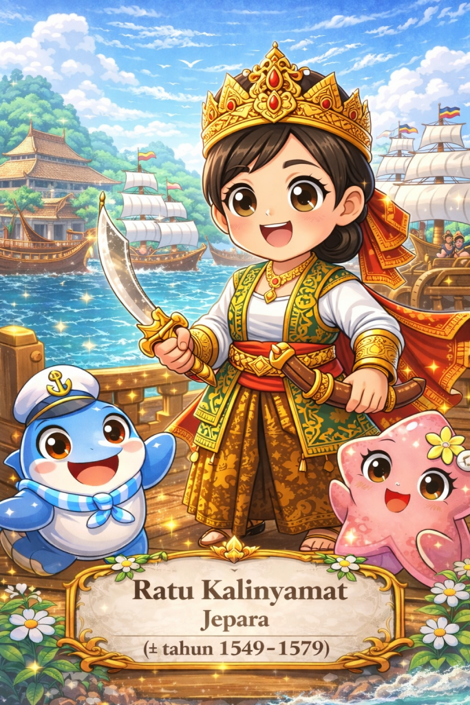
Serial Punggawa Laut Episode 6: Ratu Kalinyamat: Penguasa Pesisir yang Menjaga Martabat Laut Jepara

The Queen Who Saw the Sea as Jepara’s Gateway to the World

This image is a creative illustration for storytelling and educational purposes.

Hello, Friends of Cita & Nesia!

This time, let us return to the northern coast of Java.

Our destination is Jepara.

Today, many people know Jepara for its beautiful woodcarving traditions.

But hundreds of years ago, Jepara was also connected to a very different world.

A world of ships.

Busy ports.

Traders.

Sea routes.

And powerful kingdoms.

In the sixteenth century, one remarkable woman stood at the centre of this maritime world.

Her name was Ratu Kalinyamat.

She is also known in historical traditions as Retna Kencana.

And she became one of the best-known female rulers in the maritime history of Java.

A Queen from the Coast

Ratu Kalinyamat ruled Jepara during the sixteenth century.

Her world was deeply connected to the sea.

From Jepara, ships could travel towards other ports across Java and farther across the Nusantara.

Goods arrived.

Goods departed.

Sailors brought news from distant places.

And political relationships could stretch far beyond the shoreline.

For Ratu Kalinyamat, the coast was therefore not simply where land ended.

It was where connections began.

When Jepara Looked Towards the Sea

Imagine standing at a busy harbour hundreds of years ago.

There are no container ships.

No cranes.

No engines roaring across the water.

Instead, you might see large wooden vessels.

Sailors preparing ropes.

Merchants carrying goods.

Craftspeople repairing ships.

And people waiting for news from distant ports.

A harbour like Jepara was a meeting place.

People from different areas could exchange goods, knowledge, languages and ideas.

This meant that a strong coastal community needed more than a good location.

It needed ships.

Skilled people.

Trading relationships.

And leaders who understood the importance of the sea.

Ratu Kalinyamat became remembered as one of those leaders.

When the Portuguese Controlled Malacca

Farther west stood another important maritime centre:

Malacca.

By Ratu Kalinyamat’s time, Malacca was under Portuguese control.

This mattered because the Strait of Malacca was one of the most important maritime routes in the region.

Ratu Kalinyamat became involved in attempts to challenge Portuguese power there.

Historical accounts record that Jepara sent forces to support an attack on Portuguese Malacca in the 1550s.

Years later, in 1574, another large expedition from Jepara sailed towards Malacca.

The campaign did not succeed in taking the Portuguese fortress.

But think about what organising such an expedition required.

Ships had to be prepared.

People had to be organised.

Supplies had to be collected.

Routes had to be understood.

And cooperation with other political powers had to be built.

That tells us something important about Jepara.

It was not simply a town beside the sea.

It possessed significant maritime capabilities.

A Queen, Ships and Networks

Sometimes history is told as though powerful rulers simply gave an order and everything happened.

But maritime leadership does not work like that.

A ruler cannot sail hundreds of ships alone.

Behind every maritime expedition are many people.

Sailors.

Shipbuilders.

Navigators.

Traders.

Commanders.

Craftspeople.

Farmers producing supplies.

Families supporting those who travelled.

Ratu Kalinyamat’s story therefore also invites us to think about the wider coastal community around her.

Maritime strength is rarely created by one person.

It grows from a whole network of people.

The Coast as More Than a Boundary

KawanCita, look at the edge of an island on a map.

We call it a coastline.

Sometimes a line looks like a boundary:

Land here.

Sea there.

But people living in maritime societies may experience the coast very differently.

A coast can be a doorway.

From Jepara, the sea opened routes towards other parts of Java, the Malay Peninsula and the wider maritime world.

This is one of the interesting lessons we can take from Ratu Kalinyamat.

The coastline did not have to mean:

“This is where our world ends.”

It could mean:

“This is where our journey begins.”

A Legacy Beyond Ships and Battles

Ratu Kalinyamat’s story is not remembered only through maritime conflict.

Jepara also preserves cultural heritage associated with her era.

One important example is the Mantingan Mosque, which dates to the sixteenth century and is closely connected with the history of Ratu Kalinyamat and Jepara.

This reminds us that leadership is not only about war.

A society also builds:

places of worship,

art,

architecture,

trade,

communities,

and cultural traditions.

Maritime civilisation is made from all of these things together.

What Can We Learn from Ratu Kalinyamat?

Ratu Kalinyamat’s story gives us several ways to think about maritime leadership.

Courage — being willing to face difficult situations.

Vision — seeing possibilities beyond the immediate shoreline.

Connection — building relationships across regions.

Capability — recognising that strong maritime communities need knowledge, people and infrastructure.

And perhaps another important quality:

Confidence.

Jepara was one coastal polity among many in the Nusantara.

Yet its leaders did not necessarily think of themselves as belonging to a small or isolated place.

They participated in a much larger maritime world.

CitaNesia Insight

Ratu Kalinyamat reminds us that a maritime mindset can begin with how we see the coast.

Is the coastline the place where our world ends?

Or is it the place where our connections with the wider world begin?

For maritime communities, the sea can be many things at once.

A place to trade.

A place to travel.

A place to build relationships.

A place to defend important interests.

And a place through which communities understand their position in the wider world.

Ratu Kalinyamat’s story therefore gives us three especially important maritime values:

Courage — being willing to face challenges.

Vision — looking beyond what is immediately in front of us.

Connectedness — understanding that a coastal community can participate in networks much larger than itself.

Her story also offers an important lesson for an archipelagic country:

A coast does not have to be a peripheral place.

Sometimes the coast can become the centre of connection.

A Little Question for KawanCita

Imagine you are standing on a beach.

You look towards the horizon.

What do you see?

Only water?

Or do you imagine all the places that might exist beyond it?

Another island.

Another community.

Another culture.

Another story.

Perhaps that is one small way to develop a maritime mindset.

Instead of seeing the sea as the end of our world, we can begin to see it as a pathway towards other worlds.

That is one lesson we can carry from Ratu Kalinyamat and the maritime history of Jepara:

The shoreline is not always where the story ends.

Sometimes it is where the story begins.

— Cita & Nesia

Part of CitaNesia’s Serial Punggawa Laut, sharing stories of people, values and ideas that have shaped the maritime world of the Nusantara.

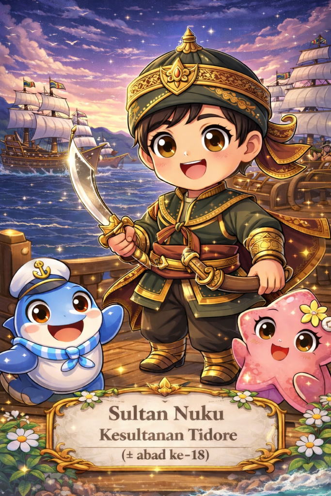
Serial Punggawa Laut Episode 5: Sultan Nuku: Penggerak Armada Persatuan dari Timur Nusantara

The Sultan Who Built Alliances Across the Eastern Seas

This image is a creative illustration for storytelling and educational purposes.

Hello, Friends of Cita & Nesia!

This time, let us travel once again to the beautiful islands of Maluku.

But we are travelling to a different time and meeting a different maritime leader.

Our destination is Tidore.

And our story takes us to the late eighteenth century, more than two hundred years after the time of Sultan Baabullah.

There, among islands surrounded by busy seas, lived a prince who would spend many years resisting foreign control and bringing communities together across a vast maritime world.

His name was Nuku.

He would later become known as Sultan Nuku of Tidore.

A Prince Who Refused to Give Up

Nuku was born into the royal family of Tidore.

His father was Sultan Jamaluddin.

But this was a difficult period for the Sultanate.

European colonial powers had become deeply involved in the politics and spice trade of Maluku, and Dutch influence increasingly affected the affairs of Tidore.

Nuku refused to simply accept this situation.

Around 1780, he emerged as an important leader of resistance.

But there was one big problem.

Nuku did not initially control Tidore itself.

So how could a prince without a secure capital continue a struggle against a powerful colonial company?

This is where his story becomes especially interesting.

He built connections.

The Sea Became His Network

Look at a map of eastern Indonesia.

You will see islands everywhere.

Tidore.

Halmahera.

Seram.

Raja Ampat.

And farther east, Papua.

To someone who thinks only about land, these places may appear separated.

There is water between them.

But Nuku understood the maritime world differently.

The sea could connect them.

He travelled through these maritime networks and gathered supporters from different communities.

Historical accounts describe support connected with Raja Ampat, eastern Seram, parts of Halmahera, and Papua.

His struggle therefore did not depend on only one island.

It grew through relationships across many islands.

Boats carried people.

Boats carried messages.

Boats carried supplies.

And, perhaps most importantly, the sea allowed alliances to grow.

Imagine Leading Without a Telephone

KawanCita, imagine something for a moment.

You want to bring people together across many islands.

But there is:

No telephone.

No internet.

No aeroplane.

No instant messaging.

You cannot simply create a group chat and write:

“Everyone, meeting tomorrow at 9!”

You have to sail.

Messages may take days or longer to arrive.

Weather can change.

The sea can become rough.

And communities may have different interests and leaders.

Yet Nuku managed to maintain relationships across this enormous maritime space for many years.

That required more than bravery.

It required communication, trust, patience and strategy.

Friends in Different Places

Nuku also understood something that good leaders often understand:

Sometimes we need allies.

His supporters did not all come from exactly the same place or background.

Different communities joined his wider struggle at different times.

Nuku also developed relationships with English traders and later benefited from British support as he challenged Dutch power in the region.

This makes his story particularly interesting.

He was not simply fighting battles.

He was navigating a complicated world of:

local communities,

island rulers,

trading networks,

European powers,

and changing alliances.

A good maritime leader had to understand all of them.

Returning to Tidore

Nuku’s struggle lasted for many years.

There were successes.

There were setbacks.

There were moments when his position became weaker.

But he continued.

Eventually, his alliances and persistence helped him regain Tidore.

By 1797, Nuku had established himself as Sultan of Tidore.

After so many years of struggle, he had returned not simply as a prince seeking a throne, but as a leader supported by a broad maritime network.

He continued ruling until his death in 1805.

Today, Sultan Nuku is remembered as one of Indonesia’s National Heroes.

A Kingdom Larger Than One Island

Here is something very important about the story of Tidore.

When we hear “Sultanate of Tidore”, we might imagine only the small island of Tidore.

But historically, Tidore’s relationships extended much farther.

Its political and cultural connections reached parts of Halmahera, Seram, Raja Ampat and Papua.

This helps us understand something important about maritime history.

A maritime kingdom does not always look like a large block of land on a map.

Its world can be made of routes and relationships.

One island connects with another.

One community communicates with another.

One harbour opens a pathway towards another sea.

The water between them is not necessarily an empty space.

The water is part of the network.

What Made Sultan Nuku Strong?

Was it simply because he had ships?

No.

Was it simply because he could fight?

No.

Nuku’s strength also came from his ability to maintain relationships.

His story highlights several qualities:

Persistence — he continued his struggle for many years despite setbacks.

Strategy — he understood that different situations required different approaches.

Alliance-building — he brought together communities across a wide maritime area.

Adaptability — he worked within a complicated world of changing political relationships.

Maritime knowledge — he understood that islands and seas formed an interconnected political landscape.

These are very different forms of strength.

CitaNesia Insight

Sultan Nuku’s story teaches us something especially important about a maritime mindset:

You do not always become stronger by standing alone.

Sometimes strength comes from knowing how to connect.

An island may be small.

But connect it with another island, and the network becomes larger.

Connect communities.

Share knowledge.

Build trust.

Maintain relationships.

Suddenly, distance does not necessarily mean isolation.

This was one of the remarkable features of Nuku’s maritime world.

The seas of eastern Nusantara did not merely surround his struggle.

They made his network possible.

His story therefore gives us four important maritime values:

Persistence — keep moving even when the journey becomes difficult.

Connection — recognise that relationships can cross seas and distances.

Strategy — think carefully rather than relying only on strength.

Unity in diversity — people from different communities can work together when they find a shared purpose.

A Little Question for KawanCita

Imagine you have a very difficult problem.

Would you rather solve everything completely alone?

Or could you ask:

“Who might know something that I don’t?”

“Who could help?”

“And what could I contribute in return?”

Asking for help does not necessarily make us weaker.

Sometimes knowing how to build a good team is itself a form of leadership.

That may be one of the most interesting lessons we can learn from Sultan Nuku.

He lived in a world of many islands.

Many communities.

Many interests.

And many challenges.

Yet he understood that the spaces between islands did not have to keep people apart.

The sea could become the pathway that brought them together.

— Cita & Nesia

Part of CitaNesia’s Serial Punggawa Laut, sharing stories of people, values, and ideas that have shaped the maritime world of the Nusantara.

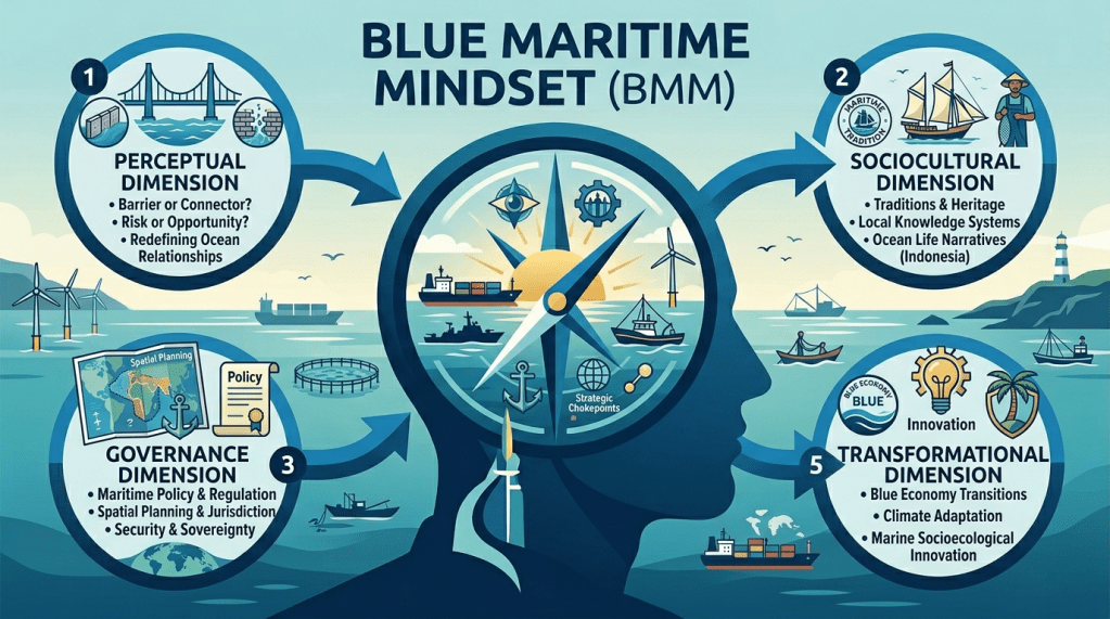
Blue Maritime Mindset (BMM): A Conceptual Foundation within GlossaryNesia

Blue Maritime Mindset (BMM)
A Conceptual Foundation within GlossaryNesia


Introduction


Within GlossaryNesia, the Blue Maritime Mindset (BMM) is introduced as a foundational concept to reframe how we understand the sea. Rather than viewing the ocean as a passive geographical space, BMM positions it as an active system of connection, identity, and strategic influence.
This mindset is particularly relevant in the context of Indonesia, where the sea is not a boundary between islands, but the very element that binds the nation together.


What is Blue Maritime Mindset?


Blue Maritime Mindset (BMM) is a cognitive and sociocultural framework that shapes how individuals, communities, and institutions perceive and engage with the maritime domain.
It expands conventional maritime perspectives by integrating:
Cognitive awareness of the sea as a living system
Cultural meaning embedded in maritime identity
Governance structures that organise ocean space
Strategic understanding of maritime connectivity and flows
In this framework, the sea becomes a dynamic medium—not only for transportation or resources, but also for energy, influence, and continuity.


How is BMM Constructed?


The construction of the Blue Maritime Mindset is layered and integrative. It emerges through the interaction of five key dimensions:


1. Perceptual Dimension
This dimension concerns how the sea is understood at the level of mindset:
Is it seen as a barrier or a connector?
As a risk or an opportunity?
Shifts at this level redefine how societies relate to maritime space.


2. Sociocultural Dimension
This dimension reflects how the sea is embedded in identity:
Maritime traditions and heritage
Local knowledge systems
Narratives and symbols of ocean life
For Indonesia, this dimension is central to reinforcing its archipelagic identity.


3. Governance Dimension
This dimension translates mindset into institutional practice:
Maritime policy and regulation
Spatial planning and jurisdiction
Security and sovereignty frameworks
It determines how maritime space is managed and protected.


4. Connectivity Dimension
This dimension highlights the sea as a system of flows:
Trade and logistics routes
Energy distribution pathways
Global interdependence through maritime networks
Strategic chokepoints, such as international straits, illustrate how the sea operates as a global circulatory system.


5. Transformational Dimension
This dimension looks toward the future:
Blue economy transitions
Climate adaptation and resilience
Innovation in marine socioecological systems
It positions BMM as a mindset for navigating uncertainty and change.


Why BMM Matters


The Blue Maritime Mindset provides a strategic lens to:
Reposition the sea as the centre of national identity and development
Strengthen maritime governance and policy coherence
Integrate local wisdom with global maritime systems
Recognise the ocean as a medium of energy, connectivity, and resilience
For Indonesia, adopting BMM is not optional—it is essential for unlocking its full maritime potential.


Closing Reflection


Within GlossaryNesia, BMM serves as a conceptual anchor. It bridges knowledge, identity, and practice—allowing maritime thinking to evolve beyond fragmented perspectives into a more integrated and meaningful understanding of the ocean.

✍🏽: Founder of Citanesia

📧 : citanesia.insan.cendekia@gmail.com

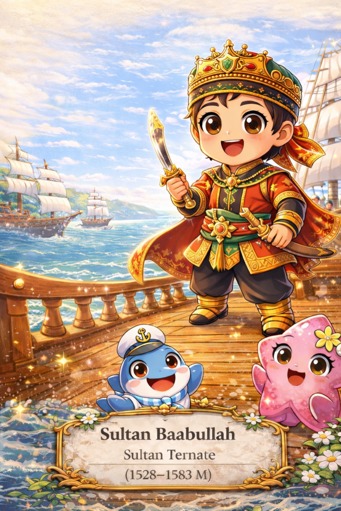
Serial Punggawa Laut Episode 4: Sultan Baabullah Penguasa Laut dari Ternate

The Sultan Who Defended the Spice Islands

This image is a creative illustration for storytelling and educational purposes.

Hello, Friends of Cita & Nesia!

This time, let us travel to the eastern part of the Nusantara.

Far across the sea, among the beautiful islands of Maluku, there was once a powerful maritime kingdom called Ternate.

The islands were small.

But their importance was enormous.

Why?

Because they were home to something the world greatly desired:

spices.

Cloves from Maluku travelled across the seas and reached distant lands.

Ships came from many places.

Traders arrived.

Foreign powers also came.

And in the middle of this busy maritime world stood a remarkable leader.

His name was Sultan Baabullah.

The Sultan of Ternate

Sultan Baabullah ruled Ternate during the sixteenth century.

He was known as a determined leader who understood that protecting his kingdom meant protecting not only the land, but also the surrounding seas.

For island communities, the sea was everything.

It was a road.

A source of food.

A trading route.

A connection between islands.

And sometimes, it was also a place that needed to be defended.

During Sultan Baabullah’s time, the Maluku Islands had become one of the most important centres of the global spice trade.

That brought prosperity.

But it also brought competition.

Foreign powers wanted access to the valuable spices and control over important maritime routes.

For Ternate, this created a difficult challenge.

When Foreign Powers Came

Among the foreign powers present in the region were the Portuguese.

Relations between Ternate and the Portuguese changed over time and eventually became deeply hostile.

Sultan Baabullah inherited a period of serious conflict.

Instead of giving up, he organised resistance.

But he did not act alone.

His strength depended on people.

Communities.

Allies.

And networks across the islands.

That is important.

Because defending a maritime kingdom spread across many islands could never be the work of one person.

It required unity.

A Struggle Across the Sea

Imagine trying to protect a kingdom made up of islands.

There are no highways connecting them.

No trains.

No cars travelling from one island to another.

The sea is the highway.

Messages travel by boat.

People travel by boat.

Food travels by boat.

And warriors travel by boat.

This meant that maritime knowledge was essential.

Leaders needed to understand routes, islands, alliances, and the movement of people across the sea.

Sultan Baabullah used these connections as part of a long campaign against the Portuguese presence in Ternate.

After years of conflict, the Portuguese were forced to leave their fort in Ternate in 1575.

For Ternate, this was a major victory.

Why Was Baabullah Called the Ruler of 72 Islands?

Sultan Baabullah later became associated with the title “Ruler of 72 Islands.”

What does that mean?

It does not necessarily mean that he personally stood on every island giving orders.

It reflects the wide network of influence connected to Ternate during his reign.

Across eastern Nusantara, political relationships were often built through islands, trading routes, alliances, tribute, family relationships, and maritime connections.

The sea helped hold these networks together.

This gives us an important lesson.

A maritime kingdom is not always shaped like a land kingdom.

Its strength can come from connections across water.

One island may be separated from another geographically, but maritime relationships can bring them together politically, economically, and socially.

The Spice Islands and the Wider World

There is something else fascinating about Sultan Baabullah’s story.

The history of Ternate was not happening only in one small corner of the world.

Maluku was connected to something much larger.

Spices from these islands travelled enormous distances.

They became part of trade networks linking Southeast Asia with other regions.

This means that communities living in relatively small islands could have enormous importance in global history.

Isn’t that amazing?

Sometimes we look at a map and think that a small island must also have a small story.

But maritime history teaches us otherwise.

A small island can sit at the centre of a very large network.

What Makes a Maritime Leader Strong?

Sultan Baabullah’s story is often remembered because of resistance and military victory.

But CitaNesia invites us to look a little deeper.

How could a leader maintain influence across many islands?

Physical strength alone would not be enough.

A maritime leader also needed:

Strategy — understanding when and how to act.

Unity — bringing different communities together.

Knowledge — understanding people, places, routes, and relationships.

Determination — continuing even when a struggle became difficult.

These qualities helped turn separate communities into a stronger network.

CitaNesia Insight

Sultan Baabullah reminds us that a maritime mindset can also be about understanding interdependence.

One island cannot always stand alone.

Communities depend on other communities.

Ports depend on maritime routes.

Trade depends on relationships.

And leaders depend on the trust and support of people.

Sultan Baabullah’s story therefore offers us several important maritime values:

Courage — standing firm when something important must be protected.

Unity — recognising that collective strength can be greater than individual strength.

Strategy — thinking carefully before acting.

Connection — understanding that islands become stronger when relationships across the sea remain strong.

His story also reminds us of something important about Indonesia.

The sea does not make islands isolated.

The sea can make islands part of a network.

A Little Question for KawanCita

Imagine you are given one stick.

It might break easily.

Now imagine many sticks tied together.

Would they be harder to break?

Communities can be like that too.

When people stand alone, challenges can feel very large.

But when people cooperate, share knowledge, and help one another, they can become much stronger.

That is one lesson we can take from Sultan Baabullah and the maritime world of Ternate:

Strength does not always come from being the biggest. Sometimes it comes from being connected.

And perhaps that is one of the greatest lessons the islands of the Nusantara can teach us.

— Cita & Nesia

Part of CitaNesia’s Serial Punggawa Laut, sharing stories of people, values, and ideas that have shaped the maritime world of the Nusantara.